- This event has passed.
MEAS Department Seminar
November 4, 2024 | 3:30 pm - 4:30 pm
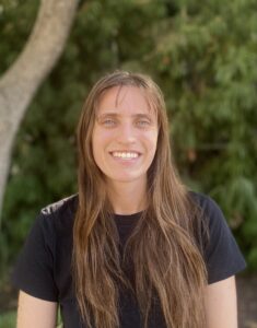
Speaker – Elyssa Collins, NASA Goddard Center (hosted by P. Liu), in person and via Zoom.
Seminar Title – Evaluating global patterns in river flows and river water storage 
Abstract – River water storage and flows are highly variable in space and time, which presents many water security challenges, such as flooding and limited freshwater availability. Traditionally, in-situ stream gauges have been used to understand dynamics in river flows and anticipate impacts. However, stream gauges are limited to a single point in space and therefore do not provide a spatially and temporally seamless understanding of river flows and its impacts. The advent of hydrological models and new satellite technology has made it possible to bridge the spatial gaps of in-situ gauges. In this talk, I will present on a recently published study in which we estimated and evaluated patterns in river flows and river storage at ~3 million river reaches globally using computer models and large geospatial datasets. I will also share some of my recent work related to the new Surface Water and Ocean Topography (SWOT) satellite river data products. These studies will highlight how both satellite data and computer models can enable us to better understand the movement of river water and advance the field of global hydrology.
Bio –Elyssa Collins is an Assistant Research Scientist in the Hydrological Sciences lab at the NASA Goddard Space Flight Center with the Earth System Science Interdisciplinary Center at the University of Maryland. Elyssa holds a B.S. in Geological Sciences from UNC Chapel Hill, a Ph.D. in Geospatial Analytics from North Carolina State University, and recently completed a Postdoctoral Fellowship at UNC Chapel Hill. While obtaining her Ph.D., Dr. Collins completed an internship in the Water and Ecosystems lab at the NASA Jet Propulsion Laboratory. Much of Dr. Collins’ work has focused on using and developing computer models, as well as leveraging large geospatial datasets such as those derived from satellites, to better understand water as a resource and as a hazard. Her Ph.D. work focused on developing and applying computationally efficient approaches to better understand flood hazards, river flows, and river storage at national to global scales. In her postdoc at UNC Chapel Hill, Dr. Collins worked on analysis and development of river data products from the recently launched NASA Surface Water and Ocean Topography (SWOT) satellite, as well as computer modeling of river flows on multichannel rivers. Now in her position at NASA Goddard, Dr. Collins is researching improvements to the river module of the NASA Land Information System.