Breaking Down the 2020 Hurricane Season (So Far)
This post was written by Corey Davis, an applied climatologist with the North Carolina Climate Office.
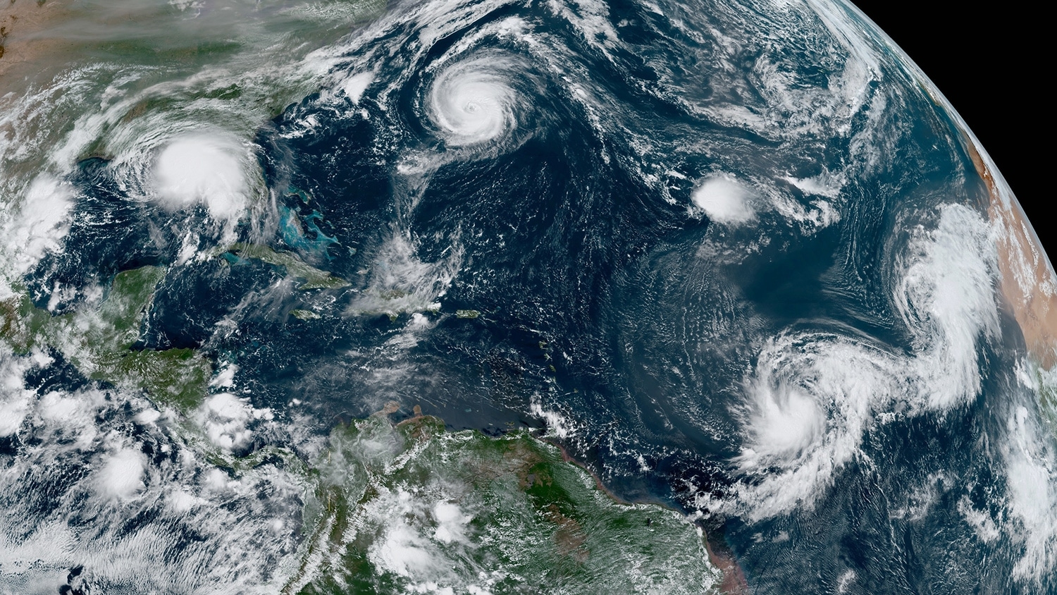
2020 has been a whirlwind in the Atlantic Ocean. Tropical activity has been on a record pace this summer and fall, and for only the second time since the current convention of naming tropical storms began in 1954, the National Hurricane Center exhausted its list of 21 names and has resorted to using the Greek alphabet.
What’s Behind the Surge in Storminess?
Scientifically, several factors across the Atlantic and even half a world away have contributed to the abnormal activity this year.
A warm ocean is fueling storms in record numbers. Tropical storms extract heat energy from warm water near the ocean’s surface. As warm and humid air rises, it creates the clouds and thunderstorms that line the eye walls and outer rain bands of developing storms.
Since the mid-1990s, sea surface temperatures across the Atlantic have been consistently above normal. In that stretch, we’ve had many of our most active hurricane seasons on record, including storms like Fran, Floyd, Matthew and Florence that have impacted North Carolina.
This warmth is partially attributed to a cyclical climate pattern called the Atlantic Multidecadal Oscillation, in which the Atlantic alternately goes through cool and warm phases for several decades at a time. Research suggests that global climate change is also playing a role. A recent study concluded that ocean temperatures since 2005 are higher than any other period in the past 2,900 years.
Moisture has filled the atmosphere from Africa across the Atlantic. The summer began with a lull in activity, in part because wind swept a cloud of Saharan dust across the Atlantic, sapping moisture from the atmosphere and preventing storms from forming across the main development region that spans from Africa to the Lesser Antilles.
But after the dust departed, a number of moisture-rich weather systems moved off the African coast. At times, we’ve had a conveyor belt-like line of storms crossing the ocean. Among the first of those was Hurricane Isaias, which made landfall in southeastern North Carolina on August 3.
Atmospheric wind patterns have helped storms grow. Throughout the summer, we’ve seen a decrease in vertical wind shear — strong winds in the upper atmosphere that can tear storms apart. One likely contributor to that is an atmospheric pattern with origins thousands of miles from North Carolina.
The El Niño/Southern Oscillation, which describes changes in sea surface temperatures across the equatorial Pacific Ocean and the atmospheric responses they induce, has been moving into a cool phase, or La Niña. That tends to weaken the jet streams and slacken the upper-level trade winds that blow across the tropical Atlantic, in turn decreasing the vertical wind shear.
That combination of ingredients has contributed to a stormy year, even before the hurricane season officially began. In late May, a pair of low pressure systems stalled over the warm waters of the Gulf Stream and developed into tropical storms Arthur and Bertha, both of which brought rainfall across the Carolinas.
Since then, the Atlantic has turned frantic at times this summer and fall. In mid-September, we saw five named storms active at the same time for the first time since 1971.
How Abnormal Is This Year?
It is worth noting that while the length of this year’s roster of storms has been impressive, and several have had damaging effects from the Caribbean to the Gulf Coast to North Carolina, not all of this year’s storms have been intense hurricanes.
“The perception of a very busy season depends to some extent on how the activity is measured,” said Gary Lackmann, a professor of meteorology at NC State. “Yes, there has been an unusually large number of named storms in the North Atlantic this season, but we are running just about average in terms of the number of days with hurricanes.”
To that point, the 27 named storms (as of publication) is nearly two-and-a-half times the long-term average, but just 11 have reached hurricane strength, compared to an average of six per year. One of the best measures of seasonal storminess is the accumulated cyclone energy (ACE), which factors in the number of storms, their longevity and their intensity. So far this year, the ACE is only 45% above normal.
Indeed, many of this year’s storms have been weak or short-lived, either because they developed close to land — like Bertha, which reached tropical storm strength shortly before making landfall in South Carolina, or Alpha, a rare landfalling storm in Portugal — or because they moved through cooler water churned up in the wake of other storms amid an often-crowded Atlantic basin.
The overall number of storms slightly exceeded expectations, although forecasts this spring called for an above-normal year in the Atlantic. The NC State research team led by Lian Xie in the Department of Marine, Earth, and Atmospheric Sciences predicted 18 to 22 named storms, not counting the two storms that formed in May, along with 8 to 11 hurricanes. Xie also expected a significant increase in activity in the Gulf of Mexico, which has held true this year.
In North Carolina, our primary impacts have been heavy rainfall and a few windy days from storms passing through. While rain from tropical storms is an important part of our climate that has helped us avoid slipping into drought this year, we’ve also seen the consequences of too much rain from these storms. Just two years ago, Hurricane Florence caused record flooding and more than $17 billion in damage across the state, and we’re only four years removed from the floods of Hurricane Matthew.
What Should We Expect in the Future?
The best available science suggests that heavy rain and flooding from hurricanes is becoming more common in our warming climate. The North Carolina Climate Science Report, which was published in March after a collaboration and peer review by climate experts and researchers across the state, summarizes the projections of our future climate, including hurricanes.
The report notes that a warming atmosphere is also a more humid one, which makes it very likely — a 90 to 100% probability — that future hurricanes will produce heavier rainfall and have greater freshwater flooding potential. It’s also likely — a 66 to 100% probability — that the remnants of storms will remain stronger and wetter as they pass through North Carolina. So along with more flooding from storms like Floyd and Matthew, we may expect storms that make landfall elsewhere like Sally and Delta to have greater impacts locally.
Confidence is low as to whether the overall number of storms will change in the future. The effects of a warmer ocean and more moisture-rich atmosphere may be offset by warming in the upper atmosphere, which makes storms less efficient, or possible increases in wind shear. However, the report concludes that the strongest storms will likely become even stronger in a warming climate.
This post was originally published in College of Sciences News.